-
Teacher's Day 'Welcome, Class!'

On Wednesday, May 29, all teachers are welcome at the teachers' day of the provincial domain Het Leen.
Over a coffee and a piece of cake, we would like to explain the educational offering of Leen and how you and your class can discover the forest. …
Translated by
 AnnouncementNew
 -
iSTEM: Further training offer

iSTEM's further training offering was expanded and streamlined.
- iSTEM nocturnes: during the spring of 2024, we will explain an iSTEM project every Wednesday evening during an online refresher course;
- iSTEM workshops on evaluation of STEM projects, …
Translated by
Announcement
-
The Wonderful Walk: Scientific treasure hunt with assignments

On this scientific treasure hunt full of fun assignments you will find science where you didn't expect it. You will discover how to measure a statue without climbing on it, how to keep your balance without falling into the Graslei, how colors work …
Translated by
Announcement (4)Other -
The Helix: Training and education in connection with environment

Through knowledge and experience exchange, awareness raising, education, training and education, De Helix helps all Flemish people to tackle sustainability challenges. They make those challenges tangible and provide tools to help tackle them. …
Translated by
Announcement
-
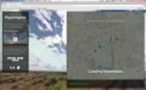
Let the sea level rise in Google Earth

On the basis of this instruction you can a teacher make the sea level rise in Google Earth.
Translated by
VideoTeacher, Other -
Using Odyssey.js: Explanation Video

Odyssey.js is a free tool to add text, integrate photos and interactive maps together to create a digital story.
This video explains how you can create a story Odyssey.js. Students can place on a map and write a text about it. There is also the …
Translated by
VideoTeacher -
Relief: Flipping the classroom

This video explains in six minutes from the significance of relief and how it is displayed on the map. There is greater emphasis on:
- slope;
- contour;
- contour interval;
- altitude and altitude rate;
- altitude zone;
- legend.
Translated by
Video (17)Teacher -
Carriers of memories: Workshop remembrance education

During this training you will receive more information about remembrance education in secondary education. We present the objectives of remembrance education, the three pillars for setting up a quality project and the partners that can help you …
Translated by
AnnouncementOrganisation, company, NPO -
Google Street View: Hyperlapse tutorial
The Street View feature in Google Maps is a handy tool, including useful in teaching geography. But you still can use this panoramic photos much more proves the design Teehan + Lax (Toronto). They made Street View imagined n hyperlapses …
Translated by
VideoTeacher -
Teachem: Make YouTube videos interactive

TEACHEM is a free web tool that lets you search YouTube videos can convert online lessons can be private or public. A variety of additional teaching and learning resources, such as Flash cards and SmartNotes make it a unique and powerful tool for …
Translated by
VideoTeacher -
Visually compare the surface of countries

Sometimes it's hard to explain how small Belgium is facing a country like Australia. The website If It Were my home there is a response.
This screencast you get to know the potential of this site.
You can not only compare the size of two …
Translated by
VideoTeacher -
Klimatogram

This tutorial explains about klimatogrammen both theory and exercises.
Translated by
Video (12)Schoolboard, ICT co-ordinator
Yummmm… cookies!
We don't like being tracked either. That's why we're concerned about your privacy.
Necessary cookies: for the proper operation of the website.
Functional cookies: for your convenience. recommended
Social media cookies: to view embedded media such as videos from YouTube, Facebook … recommended
Statistical cookies: for anonymous data collection to enhance user experience.